Weather In Brief
Always monitor your local 'OFFICIAL' sources for official information and guidance.
Here is the latest from the National Weather Service and other trusted sources
....
Thunderstorms are possible for most of the region as a cold front makes its way down through South Texas
....
The highest chance for showers and thunderstorms will be confined more towards the north and northeast across the Victoria crossroads
....
Cooler temperatures expected into the weekend
....
Here are the latest hourly area readings:
Click HERE
The Gulf Tropics Are Clear
....
See more details in the section below...
Here are some 'Quick Links':
The Current Regional Radar
Have something of general interest to the public? Go to the
CONTACT page and let us know.
END of Scroll
Click On Any Image Below For A Larger View - Click on City Name For Details
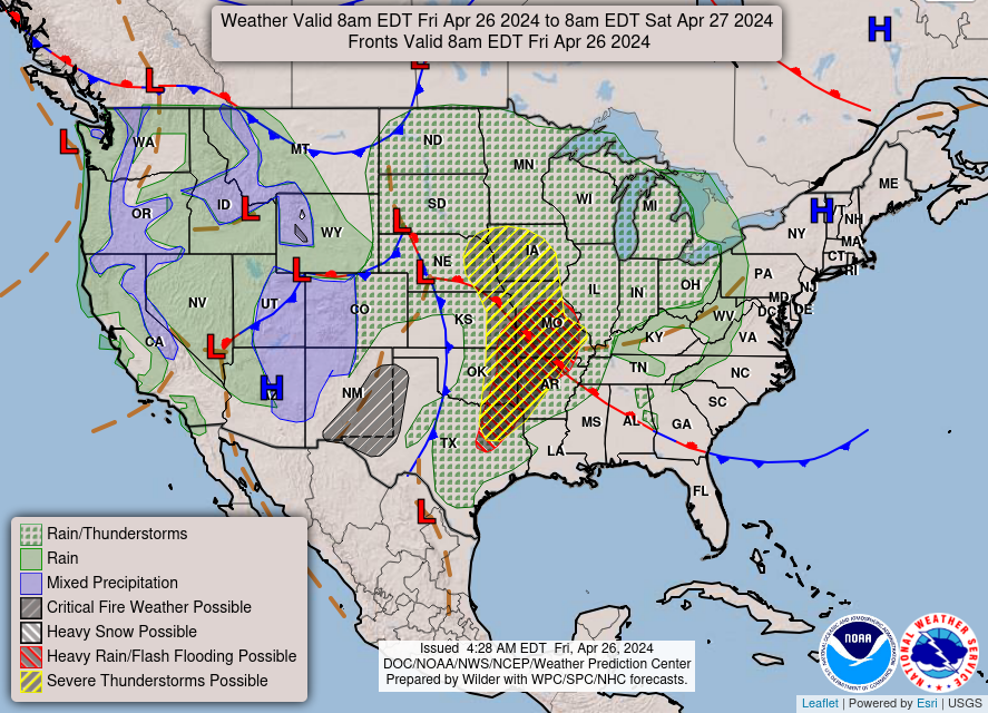


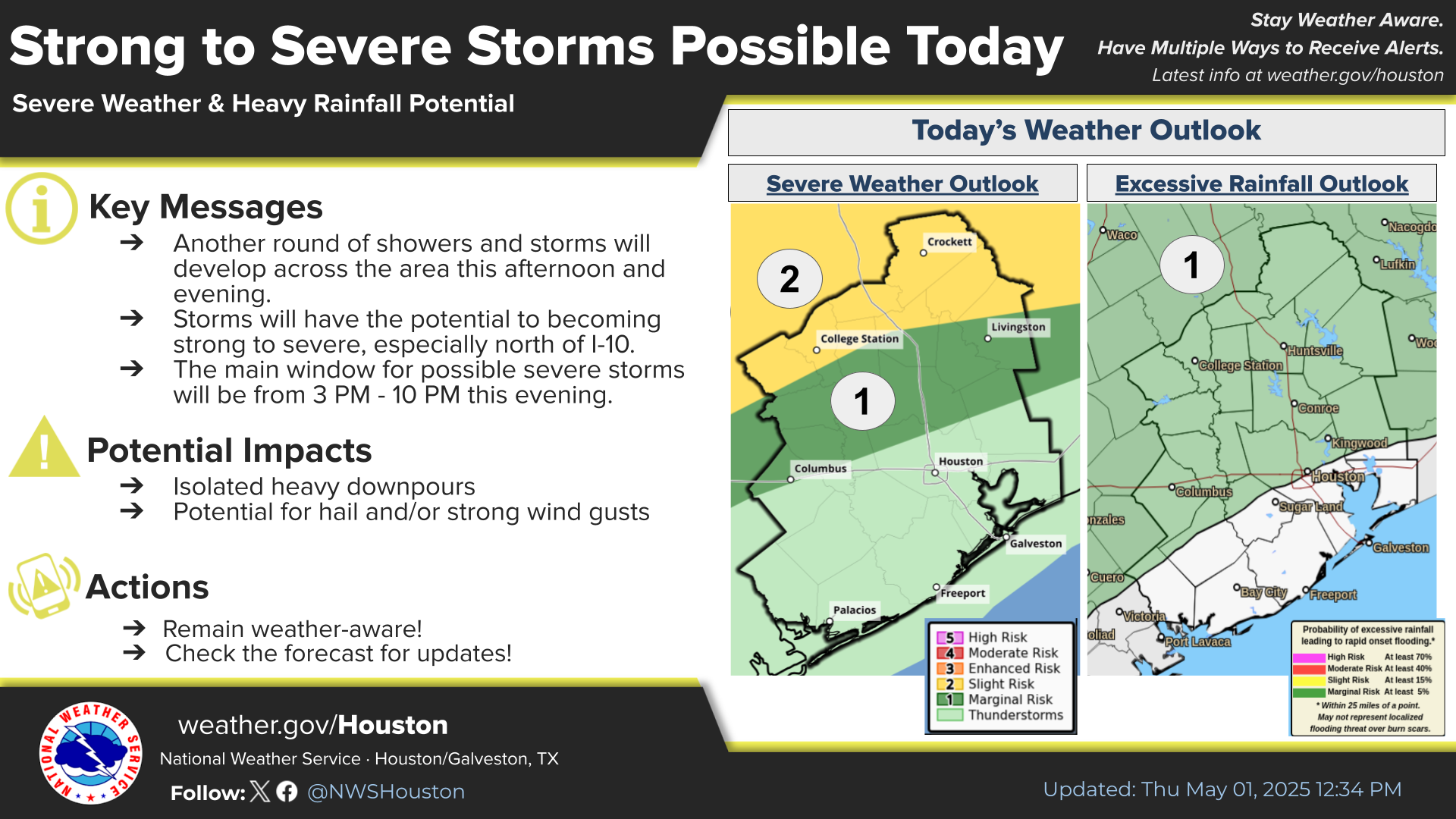
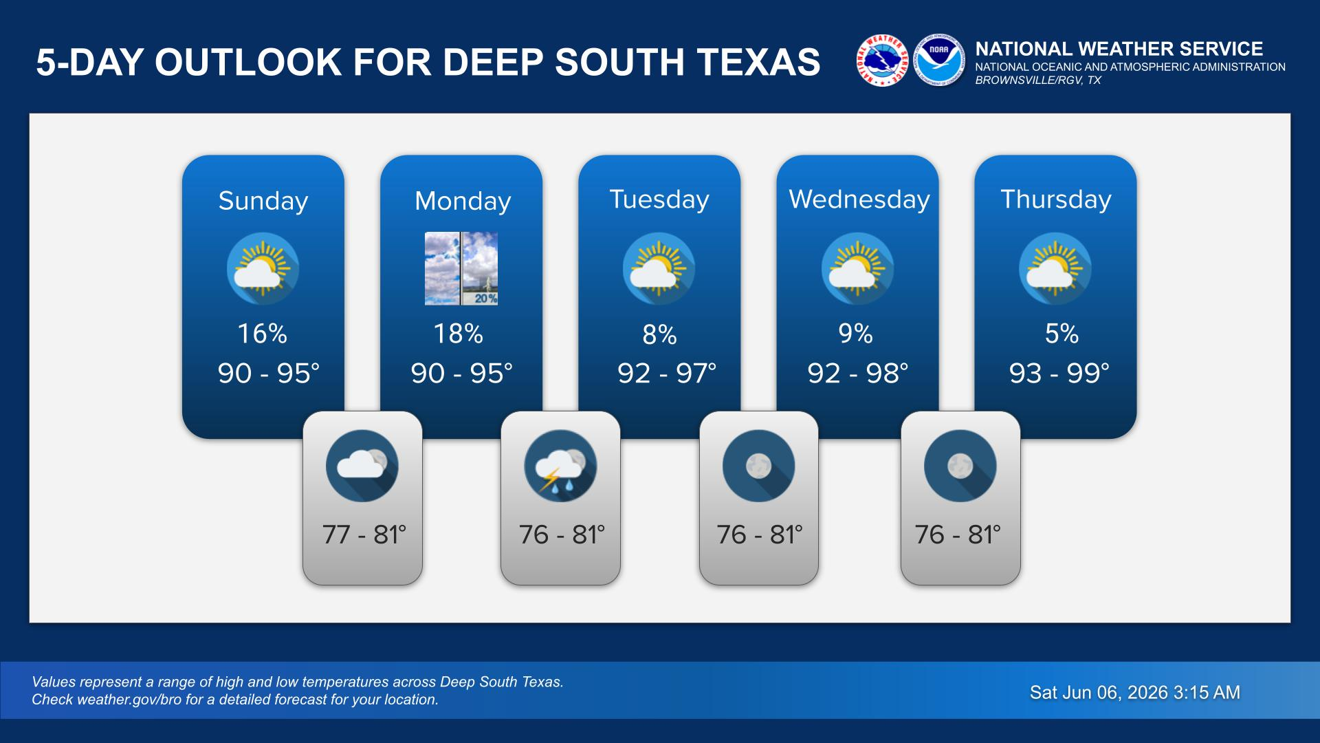


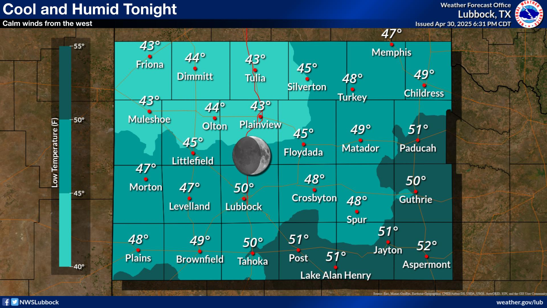

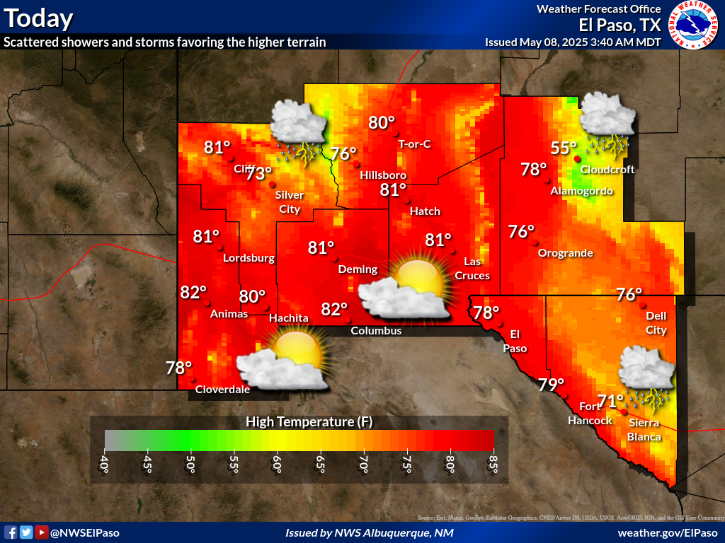
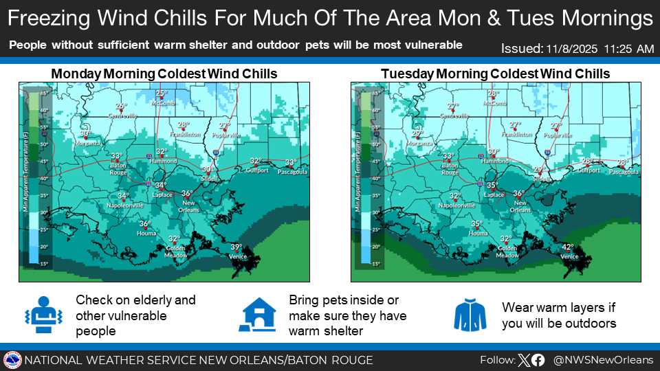
ALWAYS MONITOR YOUR LOCAL MEDIA OUTLETS AND AUTHORITIES FOR THE LATEST AND OFFICIAL INFORMATION.
Live Weather Radio - Click Below (Any of these stations May Be Temp Offline)
Once started, click on Full Screen View icon lower right corner.
Other Weather Related Sites - Click On Link Below
General Links
Click On Below Link
3 Day Loop Forecast
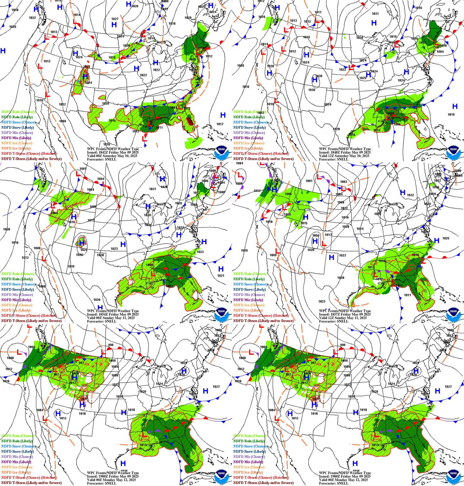
Live Video - May See Short Advertisement (Some Video May Be Temp Offline) - Click On Link Below