Local Weather Service Info - Click On Link Below
LOCAL WEATHER SERVICE HURRICANE STATEMENTS - *When Posted*
Click On Any Box For Larger View


Live Weather Radio - Click On Link Below
As of 10:30am, it is really hard to see a true center of rotation. AL-98 will be inland way to the south in just a couple of hours.
As such, the NHC has lowered chances for further development to 20%.
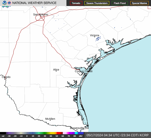
The heavier rain will stay well to the South of the Corpus Area. At this time the closest rain to Corpus is around 70 miles to the Southwest.
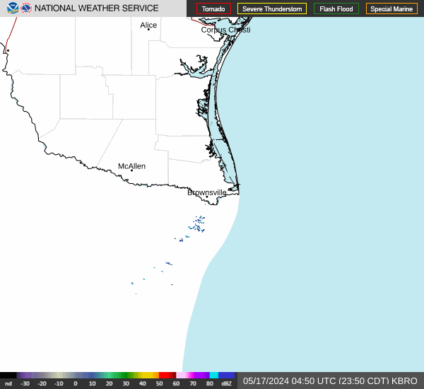
Latest from the Weather Service Corpus indicates that the parts of the immediate coastal areas may see showers with rain amounts from .1" to around .75". There are no watches or warnings posted for the Coastal Bend and none are expected. Just a flood watch for the Brownsville area.
This event is NOT a wind threat. There will be some areas of the Coastal Bend that may not even see any rain at all, especially those areas more inland away from the immediate coastal areas.
In other words, really not much concern regarding this short lived event.
Here is the latest
View From Above.
Here is the latest
Corpus Christi Radar. ---
Here is the latest
Brownsville Radar.
DISCLAIMER: This website, http://www.coastalbendweather.com, is for general information only and not to be used for any official forecast. This site is made to provide as many useful links and information possible for hurricane tracking and knowledge. Please first consult your official sources, the NWS and NHC before making decisions on any kind of weather event. We are also not responsible for the correctness of maps or data on this page.
Use Your Mouse To Move/Zoom, etc
Latest AL-98 -- Automatically Updates
Latest Wind Map View - With Your Mouse Left Button You Can Drag This View
For 'Official Information' ALWAYS rely on the official information sources from your immediate area officials for information and instructions.
Use Your Mouse To Move/Zoom, etc